Showing posts with label Outdoors. Show all posts

Saturday, April 17, 2021

Montagne D'Argent - superb hiking


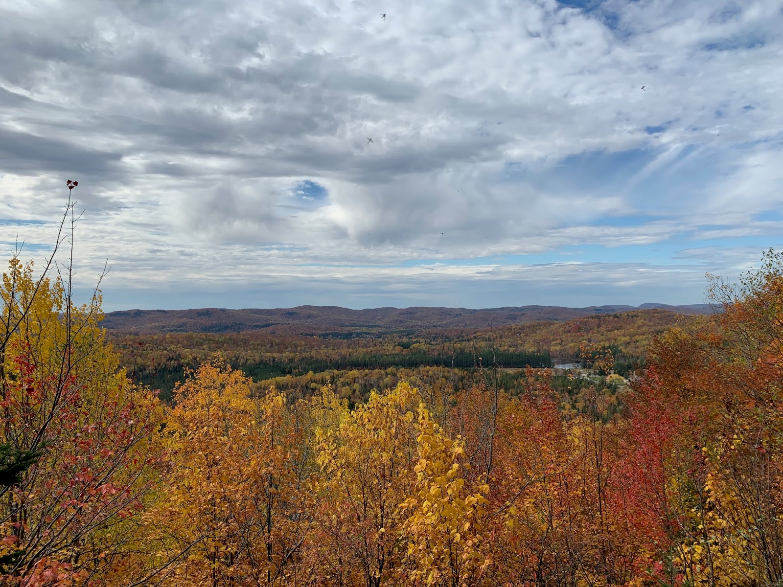
Mont Blanc as seen from one of many lookouts
In an effort to break the monotony of the COVID lockdowns, my wife scoured the Tremblant area for new outdoor activities we haven't tried yet.  A difficult task...after more than a decade in this region, we've done so much of what is on offer.  Still, she found Montagne D'Argent, a park owned by the municipality of La Conception which is about a 20-minute drive from the Tremblant resort.  You might ask why you'd drive 20 minutes for hiking when the highest peaks in the Laurentians are at the ski resort.  A fair question, and this article will tell you why.

First of all, hiking at the Tremblant resort is fantastic, as we have recounted in multiple posts.  No hike in the area affords the same "top of the world" panoramic view as you get at the peak, whether you do the climb or take the gondola to the top.  Same with the Mont Tremblant National Park...a little further afield, but a rich and varied set of hikes that are well worth the drive.  The NationalPark also offers the Via Ferrata for those who want a more extreme experience.  

But Montagne D'Argent (Silver Mountain in English) is different. Even though its peaks are less than half the size of Tremblant's, the hiking is far more rugged and the views are equally rewarding.  We visited on Easter weekend of 2021, with an unseasonably warm day.  You have to watch carefully to find it...just an inauspicious dirt parking lot on Rue de la Montagne D'argent.  Walk up the driveway and you arrive at the base camp with a small office, picnic tables and a few out-buildings that serve the year-round campers.  After we checked in and paid our day fees ($7 each for non-residents of La Conception), the attendant recommended the fullest hike that circles the outermost edges of the park.  We didn't know that the trails he suggested required a higher degree of fitness and athletic ability and so in retrospect we 50-somethings were flattered to have appeared capable of handling them.

Karen works her way up rope #1

The hike started off quite easily...a well trodden gravel path through campsites (a few occupied by hardy campers in April).  Along this flat path we passed a number of rock climbing spots - Montagne D'Argent is best known for it rock and ice climbing.  Sheer rock is on display throughout the hike, which is one of the distinguishing features from the largely woodsy hiking trails in other parks.  Before long, we turned a sharp corner and the ascent began up the spine of a stone trail.  Beautiful views of the surrounding farm land and the Riviere Rouge were almost immediately available...lookout points are frequent on these trails so you are rewarded regularly for your efforts.

The trails are abundantly marked so you never have to wonder if you've strayed, and there are occasional "you are here" maps so you can Magellan your way through the park.  The trail are also colour coded by difficulty, and we were finding the orange trail La Crete (orange is second most difficult) to be rather easy.  Until we found the surprise.  There was a sudden drop of about 10-15 feet in the trail, and the way down was via climbing ropes.  So we tossed our hiking poles to the bottom and used the ropes to rappel our way down.  That was fun!  We encountered a few of these along the orange trail and we had a lot of fun with each one. 

10 feet of ice at the base of the stairs!

Soon after, we turned onto the red trails.  The biggest difference on the reds was the depth of the drop-offs.  The rope rappels were now more like 20 feet and far more challenging.  Still manageable. but there were a few spots where we needed to plan out our footwork to get down.  Because it was early April, there were still patches of snow and ice and so in a couple spots we had fairly treacherous dealings with ice, including one spot where your only option was top slide about 10 feet on your butt to get to the bottom.  Again, all manageable, but be prepared for something that isn't the usual trail walking.  We knew something was up when the attendant asked us if we had crampons! 

After the last of the major lookout spots, we could tell we were heading back to the main camp.  It was still a considerable hike with many elevation rises and falls.  In all, it was almost a 4-hour hike, lengthened by some slow going over ice as well as a few rest spots for a snack.  Plus a cave visit that I couldn't resist (see photos below).  

We didn't venture over to see the lake, which by all accounts has a great beach as well as some cliff jumping, but we will check this out next time, likely in summer.   And there will definitely be a next time - we found Montage D'argent to be a superb hiking destination and highly recommend it!

Mont Tremblant in the distance, April sun tan in the foreground (-:

Trail narrows between two large rocks

Awesome cave, ice floor, had to go in (fyi no bears)


Saturday, September 19, 2020

Hiking - Domaine St. Bernard

One of the many lookout points
My hiking posts have been by far the most popular on my blog, where I've chronicled the excursions we've done in the National Park as well as the Mont-Tremblant mountain itself.  While these are two major hiking destinations, there's a deserving but lesser known destination to try out: the Domaine St.Bernard.

The Domaine is a 1500-acre park, which I have written about in this post.  We have been coming here for years for hiking, swimming and cross-country skiing.  The hikes don't have the sweeping 360-degree vistas you get on top of Tremblant...the "mountains" at the Domaine are much smaller.  But our Thanksgiving 2019 hike on Mont St. Bernard was so great, I need to tell you all about it.  

The unfortunate part of this post is that I left it too long to actually sit down and write it so I have lost much of the detail.  That said, I can at least tell you how to get started and show you what's in store.  This route starts with a couple minutes on the Grande Allee, a wide road cut out of a planted pine forest.  After you pass the children's maze (which is a whole other story), look on the right for the entrance to R1, Hirondelle.  It's a nice single-track path paved with pine needles.

The first five minutes or so are fairly flat, and then the gradual ascent begins.  The trails are exceptionally well marked and the footpaths are well worn, so it's easy to find your way through the woods.  Based on the timestamps of my photos, you'll be rewarded with lookouts within about 20 minutes of starting out on the trails.  The pics below give you a sense of what you'll encounter along the way.  One highlight that we want to make sure you know about (and can be missed) is a beautiful view of Lac Tremblant.  At a middle point in the hike, you'll encounter a rather steep section of trail with flat rock under foot, perhaps 40 metres long.  When you're at this point, if you turn around you'll see an opening in the trees that reveals Lac Tremblant in the distance.  We discovered this by accident the first time we hiked it - we walked right past this spot and only noticed the view when we doubled back.

Enjoy the photos below and more importantly, enjoy this hike next time you're in the Domaine!

Lac Tremblant !

View of Lac Raynaud
First lookout spot

Highest lookout on Mt St. Bernard


Sunday, September 13, 2020

Hiking Mont Tremblant - North Face

Today was a sunny, warm September Saturday and so that means the fall-colours tourism was in full force at Mont Tremblant.  Karen and I were keen to try something new but avoid the crowds, and we found the perfect solution: hike the Versant Nord (north face).  After all, we had done many South Face trails and even an excursion on the Versant Soleil, starting at the Casino.  It was time to embark from the North side, even though we couldn't find much in the way of formal trails.

North side parking lot - deserted!

These of course are COIVID times, so we arrived to find an empty and gated parking lot upon arrival.  (All the action is on the highly developed south side). We parked on the road outside the gates, as had roughly a dozen others, and headed for the mountain.  For some reason, we decided to walk up the black diamond runs on the left of the Duncan chairlift.  This would turn out to be a very direct but taxing way to ascend.   We learned later that taking the green runs to the right of the Expo chair lift would afford a much gentler ascent, but more on that later.


10 minutes in, already great views

Having skied these runs so frequently, we knew that there would be some great views of the Laurentians.  Indeed, you don't have to hike far up to to start getting beautiful vistas.  To keep our heart rate under control, we stopped frequently for a breather and took in the views, each one more dramatic than the last as we got higher up.  Taking this grassy route up was fine - few established paths but the occasional set of tire tracks worn into the ground by maintenance vehicles.  We knew we weren't the only ones hiking this slope as we found a few informal paths through the longer grasses.  One word of advice: wear waterproof hiking boots as there is ongoing runoff of water and you'll get a couple soakers along the way (I did).


Nearing the top on Saute Moutons
We started heating up in the sunshine, and decided to cool off by cutting through the woods.  We found a section of forest that we suspected was cleared for glade skiing, and indeed it was the Boiling Kettle glade run.  We emerged on the other side, and soon saw the Duncan chair lift up ahead.  It was really sunny up there, almost like we were getting close to the top.  We seriously doubted that...we hiked the south face a couple years ago and hit a false summit after what seemed like a couple hours of hiking.  Anyway we pushed on, tackling some rather steep but climbable terrain.  After 20 minutes we saw the communication tower that sits atop the summit.  We did it!  (Another word of advice - bring hiking poles if you have them.  Even on flatter terrain, they are a life saver.)

On our way down

We had read that reaching the summit on the north side could take anywhere from 60 minutes to three hours, depending on route and fitness level.  We finished the climb in about 90 minutes which included plenty of breaks, a real surprise.  At the top, there were crowds of people but plenty of room to socially distance.  The lineup for the gondola ride down was quite lengthy, which we walked right past, a little smug in our knowledge that we'd be getting down on our own.  We found a gravel path that led towards the "zone d'apprentissage", a twisting green run that leads relatively gently to the bottom.  In case we were getting a little too smug, we were passed by an older gentleman running up the mountain, and two mountain bikers cycling up to the top for another speedy descent.  The trail down turned into a gravel service road, which actually made for a couple twisted ankles as the stones rolled under your feet.  We opted instead to head down one of the grassy ski runs.

Amazing cascade

Just as we were nearing the bottom, one final surprise emerged.  We could hear the rushing of water all along the path down but couldn't see the stream.  We were coming to the end of run #77, Beauchemin Bas, and finally there was a cut out in the forest that revealed a beautiful cascade.  On a hotter day, we would have used this to soak our feet, cool down and have a snack.  Next time!  

This was an excellent hike for those who want all the beauty but none of the crowds.  Three hours from start to finish and many rewards along the way, highly recommended!

Panoramic views from the summit


Saturday, July 6, 2019

Tremblant Fly Fishing - NaturAventur

Karen sports the latest fishing fashions
Both Karen and I fished with our dads when we were kids.  Perhaps you did too...some fond memories indeed, although some rough patches too.  You were always subject to the preferences of the adults, you fished as long as they wanted to even if you were tired, and heaven help you if ever snagged your line in rocks or trees.  Fast forward to today: now we're the grownups, and we're fishing on our own terms.  Karen and I took a fly fishing expedition this week in Tremblant and it was great.


We had no fishing gear, no experience in fly fishing (except for a brief afternoon about 10 years ago) and no idea where to go in Tremblant, except that we preferred a river experience if possible.  We found NaturAventur online, and easily booked an afternoon river expedition with Denis Landreville.  Denis is an avid fly fisher as well as a conservationist in the Tremblant region, so we found the right person to guide us.

Denis kindly untangles Karen's line
We started with a brief lesson on the basics of casting and fishing technique, quite different from the fishing we did as kids.  We then got outfitted with waders, boots and rods and we were off.  While the river beside the NaturAventur "office" was quite suitable, Denis chose to take us to a more technical part of the Diable river along Chemin Duplessis, past the turnoff for the casino.  Park along the side of the road (marked with fly fishing signs), a brief trek down through the woods, and you're on the shore of the rocky Diable river.

We worked a couple different sections of the river with one-on-one coaching from Denis on how to spot the calmer waters amid the rocks where the fish were more likely to be lurking.  Denis was very patient with us beginners, untangling lines and replacing the odd lost fly.  Given his depth of expertise and years in the industry, I know he would be an equally good guide for experienced anglers.

Karen goes deep!
 It was a very hot day, and you sweat a bit in the hip waders, so bring plenty of water if you choose this adventure.  If you have your own fishing gear, that's fine.  If you prefer to simply rent gear and head out on your own, Denis can suit you up for that as well.  We really enjoyed our day and highly recommend this for beginners and experts alike!


Sunday, October 14, 2018

Mushroom Picking Excursion - Gourmet Sauvage


Gerard shows Karen the "wood ear" mushroom
Have you ever been hiking in the woods, seen an unusual looking mushroom and wondered if it was edible?  Of course you have...and you also had a loud warning voice in your head saying "don't pick it...it's probably poisonous!"  We've all been taught to avoid mushrooms unless we are absolutely certain of what they are...so Karen and I decided to put an end to this and seek an experienced guide to show us the friendly fungi growing in our midst in Mont Tremblant.  We had seen monthly articles in the Tremblant Express by Gerard Le Gal, an expert naturalist and mushroom devotee.  We spent an October Tuesday afternoon with Gerard walking through the woods near the beautiful and historic fish farm near St. Faustin, looking for mycological treasures in the surrounding woods.

Being the week of Thanksgiving, mushroom season was coming to an end, but we gave mushroom hunting a try nonetheless.  It had been a cool and rainy weekend, which we figured would provide ideal conditions for any late emerging shrooms.  Turns out, we weren't too late at all.  Of the 3,000 species of mushrooms generally available in Quebec, we found seven of the fifty edible varieties in our three-hour excursion (the fourth hour was cooking and eating!).

Yellow root!
Getting to Gerard's location was fairly quick, about a 15-minute drive from the Tremblant area.  We were already familiar with the fish hatchery, which we had encountered during a ride on the Petit Train du Nord cycling trail.  The fish farm is stunning, comprising a set of 1930's stone buildings, one of which houses Gerard's prep kitchen for a range of natural foods.  That's where we met him to begin our hike.

We spent about 3 hours in the woods, looking carefully as Gerard helped us discern between edible mushrooms and those you should avoid.  He explained that a select few actually have the power to kill you (good to know) whereas  there are many that will just make you very sick (also good to know).  Perhaps our biggest surprise was the coral mushroom and its close cousin, the whiter "crested coral" mushroom.  These look just like coral and were growing in abundance during our visit, filling a small bag full.  Gerard noted that a mushroom expert friend of his had dismissed the corals as "one-fork", that being low on the deliciousness scale.  But we found them to be our favourite.

Gerard cooks up a batch of mushrooms!
With the woodland trek complete, we headed back to a tepee where Gerard had a gas stove ready for cooking the spoils.  Naturally, everything is just a bit tastier with a bit of butter and salt.  From the chanterelles to the honey mushrooms to the corals, all were delicious as we ate the most mushrooms we've ever had in one sitting.  This was an excellent afternoon that we would highly recommend to anyone interested in learning not just about mushrooms, but other edible delicacies of the forest.

Wednesday, August 10, 2016

River Kayaking Part 4: Rouge Redux

Sand beaches and Laurentian views along the Rouge
Further to my 2015 post on kayaking on the Riviere Rouge, we picked a hot, sunny summer day for our return to this glorious river a few days ago. We catch glimpses of expansive white beaches as we head along the highway towards the airport and we had to give it a try. Rather than trying to sort out our own transportation, we paid the transport fee to the nice folks at Pause Plein Air.  They have their office at La Conception, just at exit 126 of Highway 117.  You park your car at their office, and they drive you and your vessels either 12 or 24km up-river.  We chose the 24k route which took us about 5 hours.

Karen sets up lunch at the halfway mark
The longer route starts at Labelle, which is where Kayak Cafe is located and marks the spot of our first river kayak trip.  So some of this was a repeat for us, but we were happy to revisit the beautiful sites along the way.  This is a very gentle part of the river, no rapids to deal with, and despite some rain the night before we hit a couple spots where the river was quite shallow.  If you read the river properly then there is always a pathway deep enough for kayaks and canoes.  I admit I got beached once and had to get out and walk my kayak to deeper waters, but the water is cool so it's always a pleasant mistake to make.

Lazy afternoon with doggy on board!
After a quick lunch and swim at about the half-way mark, we were now into new territory that we hadn't kayaked before.  The current seemed stronger here and we appeared to make faster progress along the way.  This is where a fresh set of river adventurers are dropped off for the 12k trip down the Rouge.  Because we are in longer ocean-style kayaks, we sped right past these folks although nobody was in a hurry.  This segment of the river has many more beaches and they are very expansive - note to self for next time, save your beach time for this part.  Before long we found ourselves approaching the double bridge of the 117 and back at the Pause Plein Air headquarters.  In all, the 24km trip took just under 5 hours although the folks on the standup paddle boards may have found it longer.  If you find yourself in Tremblant with a hot sunny day on your hands, this trip is highly recommended!

Karen enjoys a refreshing swim

Cave-like nests built by swifts along the river bank

Sunday, May 22, 2016

Hiking Mont Tremblant - Casino Edition

Ever start a hike on such a beautiful path?
By now, you may have read my other posts about hiking in the Mont Tremblant area, both at the ski resort and in the National Park.  The hiking is excellent at either location and they offer a wide range of trails at all levels, not to mention the gorgeous scenery.  This past weekend Karen and I tried something a little different, and definitely off the beaten path: we started our hike at the Casino!  That's right, and we even played a few hands of blackjack before we started.  Here's how we did it.

First, we drove to the Casino, which is about a five minute drive from the main ski resort area.  If you're lucky enough to be there when the Casino gondola is running, definitely take advantage as it's the quickest way there and the views are amazing.  It only runs on Friday and Saturday nights, and Sunday afternoons from 11-6, so perhaps a Sunday hike!  But if you're driving, you'll find ample parking in the lot as long as you get to the Casino before about 3pm, when the gamblers start turning up.  Walk towards the casino, but look just to the left of the building and you'll find a covered staircase leading down to a beautiful brick walkway.  This paved walkway was built in part to accommodate the throngs of casino visitors from the ski resort, which hasn't materialized, in part probably because they run the gondola so infrequently.  Anyway, Turn left at the walkway and follow it along until you get to the gondola station.  Turn right here and head towards the Soleil chair lift.

Still some snow in May by the Soleil chairlift
It's kind of weird seeking the ski hill with no snow...after months of skiing down this wonderful slope, it now looks more like a farmer's pasture.  Since we did this hike in May, there actually was still some snow on the hill in a couple spots, and of course I had to take full advantage and make a couple snow balls.  What perhaps best about doing this in May is that there is still considerable snow melt run-off, so we ran into a couple of amazing waterfalls right at the base of the mountain.  I'm a sucker for waterfalls so this made my day.

Anyway, we continued past the chair lift and in the distance was a wide, slowly rising trail.  This is the green run on the Soleil side of the mountain.  We made our way up this gentle slope and enjoyed seeing a few of the multi-million dollar houses built along the trail.  The views across the Laurentians here are quite different than what you get on most of the other Mont Tremblant lookout points, and that's what we came for.

We had limited time so had t turn around in fairly short order, but the hike promised to be a good one with a gradual ascent to the top.  We'll add to this post once we've done it.  If you beat us to, do let me know and I'll be happy to add your comments to this post!

Not the greatest packing snow...


Great waterfall

Monday, October 12, 2015

River Kayaking Part 3 - The Rouge

One of the reasons I started writing this blog is that much of the greatest stuff in Tremblant is frustratingly unadvertised on the web.  Kayaking information is a great example...good luck figuring out where the best routes are and where you can embark.  That's why we have chronicled our adventures in our river kayaking posts and another mystery was solved during our latest fall vacation in Tremblant.  Our trip was along the Rouge river, from La Conception to just north of Brebeuf. We drive along this river every time we head home along the 323 towards Montebello, but this time we saw the river from a very different vantage point.

Start here...if you can find it
My wife Karen got us thinking about this segment of the Rouge because she found the kayak company Pause Plein Air.  They are located in La Conception and if you want the easy way out, they will rent you a canoe or kayak and provide transportation.  We drove past their base camp, adored with a riverside tiki bar and apparently they make good pizzas, so perhaps worth a try sometime.  They also provide transportation services if you have your own vessel.  We, however, wanted to explore this for ourselves so we didn't contact the Plein Air folks this time.  Here are the details on this excellent route.

First, the access point (mise a l'eau in French) is very close to the La Conception exit off Highway 117.  The exit is marked "Route des Tulipes", and follow this road under the highway towards town.  Immediately after crossing under the bridge, you will see a small side street called Place des Tulipes on the right.  Head down this little lane (you'll pass Pause Plein Air on the left) and come to a paved cul de sac...keep heading straight onto the dirt road and you'll find a parking lot in the bushes behind.  This is your entry point!  There's a safe, gradual ramp leading to the river's edge and a clean sandy spot to push the boats in.   There are also a couple of picnic tables in case you want a snack before heading out.  We started our adventure here by dropping off the kayaks and driving down to the end point.

Yes, believe it, this is your exit point
To get to the exit point, we took Route Des Erables out of town, turning left on Route des Ormes after about 1km down the road.  Ormes travels alongside the Rouge river and eventually turns into Rang des Collines, which in turn leads all the way to the town of Brebeuf.  Before you get into metropolitan Brebeuf however, look for Chemin du Domaine des Cedres and turn left.  You'll drive about 30 seconds and come to a fork in the road: straight ahead leads to the Domaine des Cedres camp ground, and a right turn leads to a fenced in municipal building.  It's at this fork that you have found the entry point!  There's a canoe sign on a post in a grassy area littered with in sewer hole covers...this must be some sort of waste water management facility.  Anyway, head through the grass towards the forest and you'll see an obvious path.  Follow this to a clearing (you're now behind the fenced-in building) and hang a left...keep walking and you will eventually see the river.  This is your public exit point: it is fairly steep, and the "beach area" (I use that term loosely here) is a combination or rocks and muck.  You'll see a much more civilized path to the road, but this is privately owned by the Domaine des Cedres...we thought of paying them a day fee for use of this exit point but they were closed.  [Next time we will see if te Domaine wold let us exit from their beautiful beach...that would be nicer.] All in all, this is one of the less desirable exit points but hey, it's free.

The beautiful cycling back to the kayaks!
We parked our car right beside the grassy area and cycled back along the riverside to the kayaks.  The bike segment took about 40 minutes and it was fairly easy except for one nasty hill and a segment of gravel road.  We really enjoyed this part because of the great mountain scenery, the proximity to the river and the idyllic countryside.  Fall colours were just starting to come out (late this year) and we lucked out with a nice sunny day, albeit it about 12 degrees.  The other nice thing was the lack of car traffic on these roads so the biking felt very comfortable.  We also did something in La Conception that you can't do in a car, and that was to cross the river via Rue de Centenaire, which features the most magnificent covered bridge we've ever seen (see photo below).  It's pedestrian only and features towering post-and-beam construction, windows on both sides and now serves as an event space.  This is a must-see!

Behold the covered bridge
Now back at the kayaks, we locked up the bikes beside the picnic tables and set out.  As I mentioned above, this is a great entry point, in stark contrast to what awaited at the end.  Just ten seconds into the kayak, you pass the Pause Plein Air encampment on the left, turn a corner and you're instantly rewarded with a grand view of the covered bridge.  Stay left as you go under this bridge because the centre channel is quite shallow...when we kayaked in the fall, the water levels were low so this spot (and several points beyond) had the potential to beach you, even in a kayak.  This part of the trip was the most densely populated along the riverbank and we enjoyed snooping into the back yards of the local La Conception home owners.  [If you have a chance, there are some exceptional historic homes in town along rue des Lilas to check out...there's not much else to see in La Conception but we enjoyed these homes as we searched for the mise a l'eau.]

Looking back - beach and mountain
Like other parts of the Rouge that we wrote about in our first posting on river kayaking, this segment is gentle with no rocky rapids to deal with [although some low grade rapids are always fun].  It also features many sand beaches, most of which are privately owned but there are a couple quality spots to pull up and have a snack.  But the best part of the trip is all the mountain vistas...the mountains are great through this stretch, kind of lumpy, so it seems like every time you turn a corner you're heading into another great view.  Add in the fledgling fall colours and it was truly spectacular.  We passed a couple of campgrounds as well, but given it was early October, they had pretty much closed for the season.  In summertime, guaranteed to have lots of people waving "bonjour" on the shore.

Look for this sign - it's your exit point!
After a couple hours of kayaking, we started keeping a keen eye out for the exit point.  We knew we'd pass the large beach owned by Domaine des Cedres on the right, immediately after which we'd see the sign.  Well, we had a couple false positive identifications of the beach along the way but after about two and a half hours, we finally got there.  I thought the signs might be easy to miss, and if we passed them by accident, the river leads to the fairly treacherous Blueberry Falls (chute aux bleuets).  But, the signs are very conspicuous, particularly if you are looking for them on the right side. The extraction was as awkward as we had anticipated...some muck to wade through by the water's edge, and a bit of a grunt getting the kayaks up the slope and through the paths. But our car was right there waiting for us and we were glad we did this excellent segment of the Rouge!

The Rouge - very wide at points, and windy!
Next up: there's another segment of the Rouge starting just down-river from this that we haven't done yet, but will post information on it here as soon as we've done it, likely in 2016.  We'll target spring/summer when the river is a bit higher as it appears there are some shallow spots along this route.  It starts at Brebeuf beach and we believe we'd be able to park in the beach lot on Chemin de la Rouge (or along the road as people do) and put the kayaks in at the walkway to the beach.  The exit point is about 14km down the road - drive along Chemin de la Rouge, and just outside Huberdeau, the road ends and you bear left on Rue Principale.  Shortly thereafter, turn left on Rue de Fer a Cheval and take it out to its furthest point.  This is a residential area but you'll find a small public beach where the kayaks can be extracted.  It's just across the river from the Arundel Golf Course so that should serve as a good signpost that the trip is done.  We saw some rocky rapids in parts of the river as we drove the route this fall, but nothing aggressive.  We also consulted our river map and the rapids are marked as low/moderate so nothing scary (but indeed fun).

July 2018 Update

Karen sets out from Brebeuf beach!
We finally did the segment of the Rouge mentioned above, although it took us a couple more years to get around to it than expected.  I would rate this as the best river kayaking experience we've had to date, although it didn't turn out exactly as we had expected!  I must say we had perfect weather and couldn't have designed a better day.  25 degrees celsius, clear skies, zero humidity and a wind at our back as we kayaked.  Amazing!

Let's start with a pat on the back for me and my awesome planning - the trip went almost exactly according to schedule.  Here's what we mapped out:


  1. Leave the house at 10:15 with kayaks and bikes loaded on/in car
  2. Arrive at Brebeuf beach, and have the kayaks unloaded by 10:45
  3. Arrive at Huberdeau to leave the car and set out on bikes by 11:15
  4. Cycle back to the kayaks and lock up the bikes by 12:15
  5. Lunch, and then start the kayak by 12:45
  6. Arrive at the end point in about 3-4 hours (the trip took us about 3 hours)

We had a couple concerns when we scoped out the trip.

Beautiful field of yellow stuff
The first was that the bike trip would take too long...it felt like a long way driving it in the car, but we finished in about an hour.  It's just 15km so we had no rational reason to fear the cycling.  We had considered cycling from Huberdeau along Chemin de lac a la Loutre as it seemed like a wider, safer roadway and a more direct route.  But Google Maps showed us it was also a lot of aggressive up and down took the flatter Chemin de la Rouge.  A good decision...this route provided beautiful river views as well as stunning countryside scenery.  The Huberdeau/Arundel region is quite spectacular and this route truly reveals the beauty of the area.

Karen surveys the beginning of the rapids
Our second concern was the rapids.  I smirk now as I reread the comments above where I mentioned some low/moderate difficulty rapids.  We had scoped out this route in May of this year when the water levels were high, and the rapid were violent.  The rushing of the water was deafening and so our conclusion was that we would wait until water levels were low, or find a way to portage the kayaks around the rocks.  But the water levels were low this July, and the rapids seemed tame by comparison so we decided to brave them!  Long story short, my wife Karen navigated them brilliantly, but I got turned sideways against a rock and flipped over.  I managed to eventually get my kayak to shore, dumped out the water and resumed, but not before a few bumps and bruises and a few key lessons learned.  Based on that experience I think I should share a few thoughts about these rapids for anyone considering taking this route.

First, if you look at the river maps produced by Federation quebecoise du canot et du kayak [whose acronym is FQCK, haha] they rate these rapids as class 2, which are described roughly as "moving navigation, maneuvers, passes, regular waves". They also provide the additional rating of EV, which stands for eau vive. The description of EV is "white water (strong current with small waves and some rare rocks)". There was definitely white water, and the rocks were anything but rare as I was thrown into a few of them and got a little banged up. A more experienced kayaker would know better, but I suspect these rapids were a bit much for our long kayaks and we should have been in something shorter and more nimble, and skirted. I probably should also have had a helmet on for this. I did have a life jacket on and that was a huge help - the water was far deeper than I thought. After my kayak tipped, I was fully submerged and couldn't touch the bottom with my feet. If you are considering this trip, I suggest you check out the rapids in advance and be cautious. If you aren't confident in your skills, there apparently is a portage to the left of the rapids.

Amazing white sand beach
Ok, enough drama.  Inasmuch as the rapids were fun, the real highlight of the trip was the beautiful surroundings.  About 5km into the kayak, we came across a magnificent white sand beach that was completely uninhabited...or so it seemed, as all the nice beaches have somebody's loungers or umbrellas on them, or an abandoned fire pit, and this had nothing.  It was too early for lunch so we just stopped and admired it before moving on.  Next highlight is the confluence of the Diable and Rouge rivers.  Yes, the might Diable that runs through Tremblant empties out into the Rouge.  See the photo below...it may be hard to discern but the Diable is on the right (where Karen is, she paddled up the Diable a bit) and the Rouge is on the left.  There is also a great red sand beach just opposite the confluence that would be worth a visit on a future trip.  The other highlight was the bank swallows nesting in the high river bank.  We've seen this elsewhere and it's fun to see the nimble little birds swooping into their holes.  All three of the these sights are within 500m of each other.

Hidden beach at Huberdeau
After the rapids, we had a few more K's of river to enjoy, alongside the Arundel golf course on the left.  This was a much-welcomed return to calm water, and before long we were at the secluded little beach near Arundel.  When we arrived, there was a couple enjoying a sunny afternoon and they were stunned to see us paddle up.  I guess there isn't much through traffic on this river!  This is a very easy departure point, and to find it easily, just type the following into Google Maps: 45.975516, -74.622500.  There is parking for about 4-5 cars beside the road so if you use our method, it's a good place to leave the car during the bike/kayak segments of the trip.

This was an excellent day and highly recommended, with the cautions I made above.  This segment of the Rouge is wide and relatively straight, offering dramatic views along the river.  Enjoy!


Bank swallows inhabit the upper portion of this river bank.  Can you see the holes?

Relaxing along the river...strong current makes a easy paddling

Rouge river on the left, Karen paddles in the Diable river on the right


Sunday, June 7, 2015

River Kayaking: Part 2

Karen embarks on the Riviere du Nord
Considering how many updates I made to my first installment on river kayaking, this is probably part five...anyway, we keep finding great new places to kayak and I figured I'd create a new entry for the latest trips we took during our September 2014 holidays.  This time, we had identified two new river segments (well, new to us) in both St. Jovite and Val David.

The first we did was Val David, and planned an over-nighter for this one.  We stayed at La Maison de Baviere, a charming German-inspired B&B built on the foundation of an old stone house, right on the rushing waterfalls of the Riviere du Nord.  It's also right beside the P'tit Train du Nord for easy access to cycling, and about a 5 minute walk to the main street for dining.  We did a bit of cycling the first afternoon and made a mandatory stop at Le Baril Roulante for a pint or two of the best Quebec microbrews.  That night we had dinner at Les Zebres, trying to carb up for the adventure the next morning.

The river empties into Lac Raymond, beach to the left!
So our kayak trip began just a little bit down river from our B&B, so we had the ideal location to start this trip (although you're never too far from anything in Val David).  Planning a kayak trip like this is a bit like those logic problems where you have to get a fox, a chicken and a bag of feed across the river with just one boat.  We were equipped with two kayaks, two mountain bikes, two sets of bike locks and a roof-racked car.  Here was the solution:

  1. Drop the kayaks at the starting point.  There is an official entry point just at the end of Rue St Olive where it meets Chemin de la Riviere.  Lock up the kayaks with the bike locks (although who's going to make off with our boats?  How quick a getaway could you make?)
  2. Drive to the finishing spot, which is at Lac Raymond.  There is a parking lot just off of Chemin de la Gare, complete with a small beach for easy disembarking.  We left the car here, hopped on the bikes and cycled to the P'tit Train du Nord which leads back to the B&B, from which it is a 60-second cycle along Chemin de la Riviere back to the kayaks.
  3. Back at the kayaks, we now put the locks on the bikes and embarked down the river.  It's a crazy winding river where at one point, you actually head back north toward where you started, after which you sweep back south.
  4. As the river empties into Lac Raymond,  hang a left and arrive at the beach.  Drag the kayaks to the car, secure them on the roof racks and drive back to the bikes.
  5. Unlock the bikes, back into the car and head home!
    We made it...success!
The whole rigmarole took about 2.5 hours end to end...probably sounds like a big hassle but it isn't really. And the opportunity to explore a new segment of river is always worth the effort.

So speaking of new segments of river, we also kayaked the Diable River route that extends south from St. Jovite.  In our first post on river kayaking, we recounted our experience on the amazing trip that starts near Old Tremblant at the pont de fer (iron bridge), finishing just behind the new townhall in St. Jovite.  This time, we started at the town hall and continued south.  Funny thing is, we always figured that we could probably just keep paddling and disembark near the covered bridge south of town.  The Tremblant outdoor gods were listening and now it's an official route!

Karen eases into the crystalline waters
The same logistical problem applies to this trip.  Our approach:
  1. Drop the kayaks behind the St. Jovite townhall
  2. Drive out to the extraction point at the covered bridge.  Head south on Rue Leonard (Hwy 327) for about 4-5km and watch for chemin du pont Prud'homme on the right.  The red covered bridge is just a few hundred metres down the road and there's a small parking lot beside.
  3. Leave the car here and cycle back to the kayaks.  Seems like a long way but not even 6km!
  4. Lock up the bikes behind the townhall and kayak away!
  5. Extract, load the kayaks, drive back and pick up the bikes.
  6. Have a quick pint at St. Arnould on the way home.
When you start the kayak, you enter such tranquil waters that you wonder whether you're actually experiencing any current at all.  That though vanishes quickly once you approach the rapids that splash under the first bridge.  You're passing under the Trans-Canada highway (Rte 117) and these are the roughest rapids on any of the official river routes.  Nothing to worry about, no capsizing risk, but I did take on a bit of water!

Beautiful views of mountains and farm from the beach
Like much of the Diable river upstream, this route is gentle and picturesque but now you are in farm territory.  No golf courses, cottages or trailer parks.  You are drifting through the valley, mountains on either side.  We also encountered a few hunters perched in a treetop duck blind, so we had to shout in our best French that we were approaching (ne tirez pas!).  About two-thirds of the way through, we found a beautiful sandy beach.  It was about 22 degrees on a sunny September afternoon, so we stopped for a quick snack and to feel the warm sand in our toes.

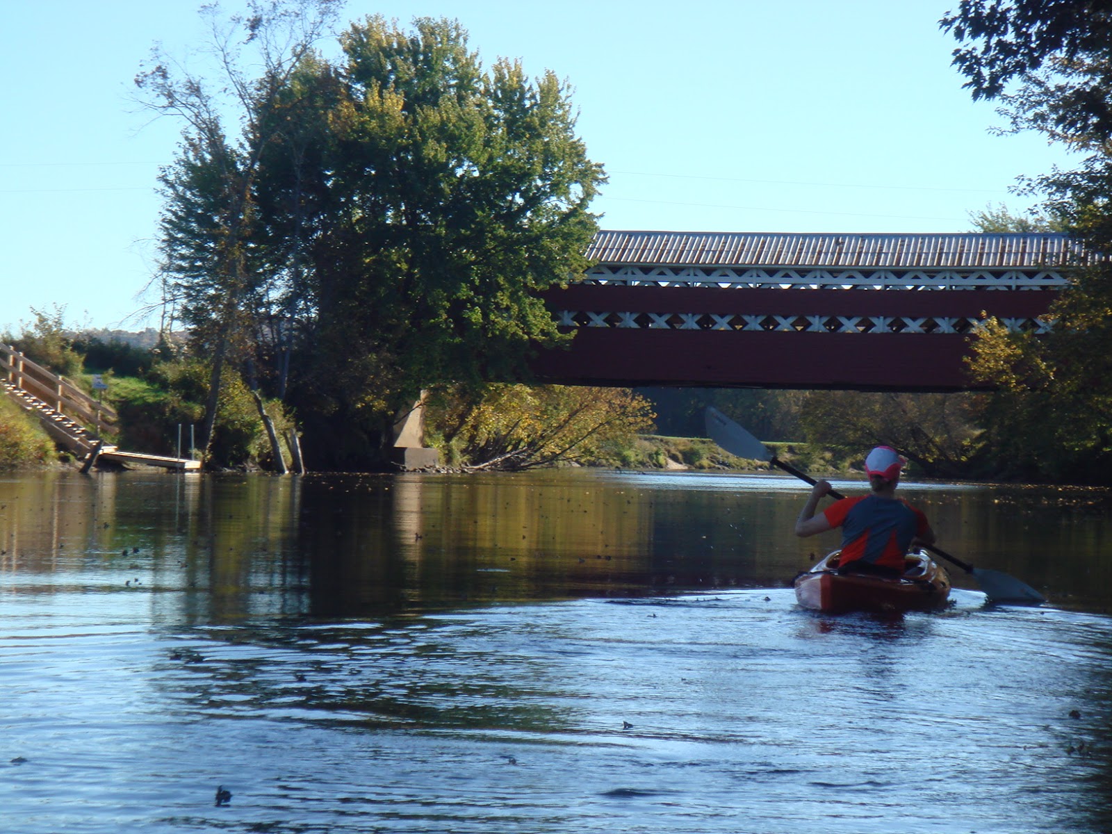
Prud'homme bridge, the dock on the left
Back on the water, the river straightens out a bit now after twisting its way through the valley.  Turn a corner and there is the beautiful historic covered bridge...and for your convenience, a dock for easy extraction of your kayak.  The river bank is quite steep so there is even a wooden ramp to assist in dragging your boat to the top, complete with a crank if you need the help.

When you're done, you're likely to see a few people standing around the covered bridge with cameras, looking about in amazement.  There's nothing flashy or dramatic about this spot, but there's something idyllic about the countryside and we highly recommend you experience it for yourself!

Oct 2015 Update:
Read about our kayaking on the Rouge near La Conception in River Kayaking Part 3!